Kirsten Kennedy has the coolest job.
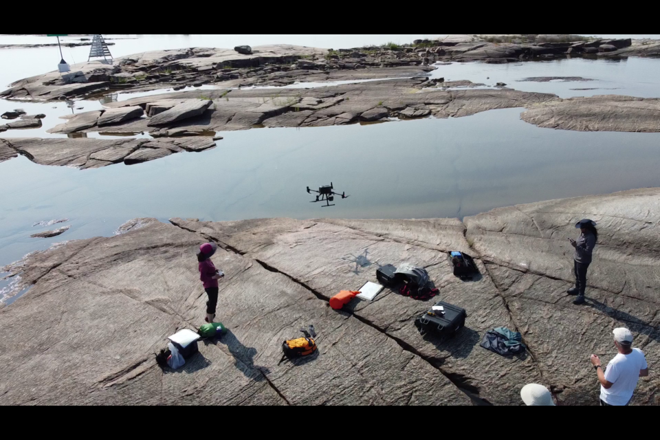
The researcher is spending her summer travelling throughout the Georgian Bay watershed with a drone equipped with LiDAR (light detection and ranging) technology mapping the region in a “point cloud” of light.
The University of Toronto post-doctoral geologist received a $67,494 grant for the project from the Trebek Initiative. Named after Alex Trebek, the late host of Jeopardy who had a passion for geography, the Initiative funds fieldwork and storytelling through the Royal Canadian Geographical Society and National Geographic.
“The project is to document and map the geo-cultural landscape of Georgian Bay,” said Kennedy.
“Georgian Bay has an incredible geo-cultural landscape. It’s a landscape that has evolved over billions of years, but in the last 10,000 years has been occupied by people.”
Indigenous people have lived through tremendous changes in the climate from when glacial Lake Algonquin covered the region to today, Kennedy said.
“People have continued to live here and their culture has evolved. I’m looking at the interconnection between the people that lived here and the environments by mapping out the landscapes.”
But there is also a larger project in play.
The results will inform planning on the Georgian Bay Geopark project, now in its formative stages, with the goal of attaining UNESCO status. UNESCO is the United National Education, Scientific and Cultural Organization. It has established 177 geoparks in 46 countries, five in Canada.
Kennedy is being advised by members of the geopark advisory committee with includes Midland Deputy Mayor Jack Contin and former Huronia Museum Curator Jamie Hunter.
“Jack Contin is invaluable in providing assistance because he has the Indigenous contacts and getting us into talking to the right people,” Kennedy said.
Hunter is pointing Kennedy to locations that are known archeology sites of Indigenous villages.
“We have been able to scan archeological sites and there are hundreds in the region,” she said.
LiDAR projects a laser light beam from the drone to the surface which rebounds to the device creating thousands of data points that together make a map.
“LiDAR is useful because it can see below vegetation,” said Kennedy, noting, for example, it can portray anomalies that can be the remains of villages.
The type of rock and height of land are features that have a direct consequence as to how people lived and continue to live their lives, said Kennedy.
For example, Indigenous people living on the Canadian Shield with its rock which is more than a billion years old, lived by hunting and fishing, whereas people that lived in Huronia (North Simcoe) had richer soil that could be farmed.
“That’s what the Wendat were doing and they had relationships with hunters on the Shield,” she said.
Her work is being described as “two-eyed” seeing as it combines Indigenous history with LiDAR technology.
“The focus is on telling the stories, but we tell the stories through the geo-park. That’s what geo-parks are good for. They allow us to educate the public about why geology is important to people,” she said.
Kennedy is passionate about this sort of outreach.
“I want to tell people that geology is really important to every aspect of our lives. We just don’t realize it.”
The development of the geo-park not only provides a vessel in which to educate people, it can provide a conservation planning component as society continues to evolve, Kennedy said.
“More and more people are coming here to live and for tourism and we want to make sure it’s done in the right way and we don’t ruin the landscape in the process.”
For more information about the Georgian Bay Geo-Park visit the website.
For more information about the Trebek Initiative click here.


