WEATHER ALERT
ENVIRONMENT CANADA
*************************
Snow squall watch in effect for:
- Barrie - Collingwood - Hillsdale
Snow squalls expected Monday through Tuesday afternoon.
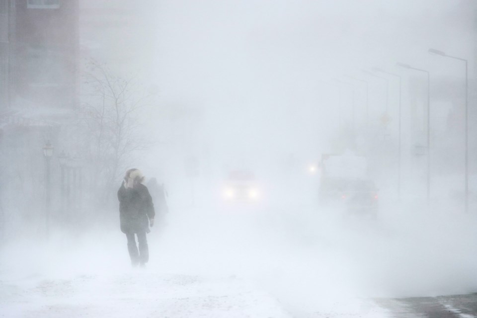
There is potential for snow squalls to develop off Lake Huron beginning Monday morning and continuing through Tuesday afternoon. These snow squalls will bring rapidly accumulating snowfall resulting in near zero visibilities at times. Strong northwesterly winds will also aid in reduced visibilities due to blowing snow.
The strongest snow squalls are expected Monday and then expected to move southward out of the area by Monday night. Less intense snow squalls are possible Tuesday morning before weakening to flurries Tuesday afternoon.
Local snowfall accumulations of 15 to 30 cm are likely by Tuesday morning with areas experiencing persistent snow squalls possibly exceeding 30 cm. Additional snowfall amounts near 5 cm are expected Tuesday however there still remains some uncertainty at this time.
Snow squalls cause weather conditions to vary considerably; changes from clear skies to heavy snow within just a few kilometres are common. Travel may be hazardous due to sudden changes in the weather. Surfaces such as highways, roads, walkways and parking lots may become difficult to navigate due to accumulating snow. Road closures are possible. If you become stranded in a vehicle do not leave. The vehicle offers a form of protection from the cold. A single person walking through the snow is harder to find than a stranded car or truck.
Please continue to monitor alerts and forecasts issued by Environment Canada. To report severe weather, send an email to [email protected] or tweet reports using #ONStorm.
*************************


