Cycling enthusiasts will soon be able to ride along the waterfront in Tiny Township.
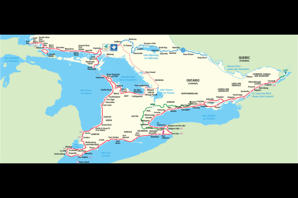
Council committee recently approved a partnership with the Waterfront Regeneration Trust (WRT) that would connect the municipality with 3,600 kilometres of existing trail system in the province.
The approval now awaits council ratification at its next meeting, however staff have been directed to begin working with WRT to identify routes that could become a part of its extensive network that connects 155 communities, villages and First Nations in Ontario.
"The goal of this group is to have this connectivity through our entire great lakes system," said Tim Leitch, director of public works. "There are a couple of gaps and Tiny happens to be one of those gaps.
"The proposal is to connect those gaps — Collingwood up to Penetang and Midland and beyond," he added.
There's an annual fee of $3,500, which will be covered by the County of Simcoe, according to the staff report submitted to council committee.
Leitch said the $8,500 required for signs and maintenance are already in the municipal budget.
WRT executive director Marlaine Koehler said the non-profit is thrilled with Tiny Township's decision to add to its waterfront trail system (interactive map) to the Great Lakes Waterfront Trail.
"We can’t think of a better way to celebrate the Great Lakes Waterfront Trail 25th anniversary than by expanding it," she added.
Leitch said staff has been working with the group for a couple years to develop connectivity along Tiny's waterfront.
"We did a trial with this and we did a drive around with the group and dveloped a route that would get us as close to the shoreline as we could," he said. "It took over two hours to do that drive. It's a large municipality and there's a lot of great biking along there."
Coun. Gibb Wishart asked if the route had been finalized yet.
"I hope this is moving target that you're developing," he said. "Obviously, the safest route is on our trails and to minimize road use, but that's probably the most boring as well. So as we develop roads that have an area marked out for walking, biking and pushing a stroller, can we keep changing and not be committed to any one route for the moment?"
Leitch said staff had concerns around the route and to make sure a safe option is made available to the group.
"That's how the group is approaching it," he added. "If a route becomes danegrous or doesn't work they're open to looking at ways to continue to improve it and allow people to travel as close as they can to the waterfront and have great vantage points."
Leitch said the municipality's role is to help identify the appropriate routes, put up signs indicating different types of hazards, such as poison ivy, as well as cautions around road shoulders, or the lack thereof. He added it would also have to caution people using the trail to only use public and municipally owned beaches and not to venture onto private property.
Koehler said this is a way for communities along the trail to showcase their uniqueness to people and increase tourism. The non-profit produces a map that lists all the stops along the trail, including amenities, such as restaurants.
"We find when trail users are using waterfront trails they see it as a part of regenerating the waterfront," she said. "I think everybody gets the idea. We want to show people we have one of the world's greatest gems and we need to take care of it and love it in a way that respects it."


