BarrieToday welcomes letters to the editor at [email protected]. Please include your daytime phone number and address (for verification of authorship, not publication). The following letter is in response to a story titled 'Provincial Green leader 'disappointed' with feds not stepping in on Bradford Bypass,' published on Feb. 10. Letter-writer Iain Craig lived in Holland Landing for 11 years and has paddled extensively on the east and west branches of the Holland River and the Holland River Canal. In 1996, he organized a re-enactment of Governor Simcoe’s trip from York to Huronia.
*************************
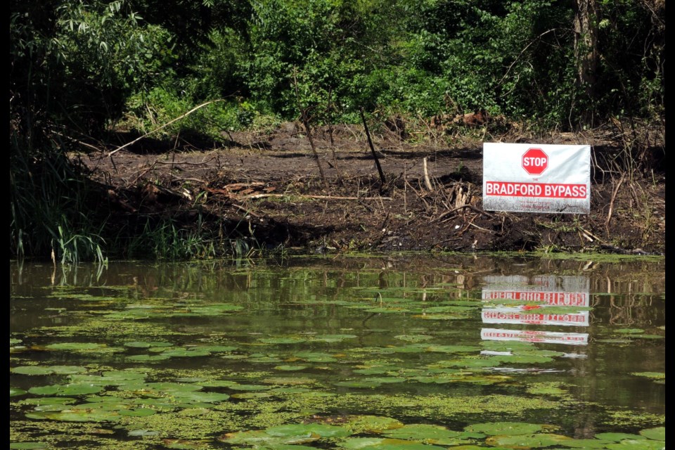
The Lower Landing is on the east side of the east branch of the Holland River, just north of the Queensville Sideroad and south of Silver Lakes Golf Course. There has been a great deal of interest in the Lower Landing, also known as the Red Pine Fort, due to the proposed Bradford Bypass.
Not all of the published historical information is correct. So this has been written to add some historical facts.
The proposed route would take this four-lane highway through the site of the Lower Landing. A great deal of research has already been done, and it is quite clear that First Nations people had been using this spot for thousands of years.
FROGS (Forbid Roads Over Green Space) states: "The Lower Landing was the northern terminus of the Carrying Place Trail.” The terminus of the Toronto Carrying Place Trail was at a spot on the West Holland River, just north of Highway 9, west of Weston Road.
The terminus of the Toronto Carrying Place Trail is 14 kilometres from the Lower Landing. There is absolutely no conclusive evidence to support a suggestion that there ever was a First Nations trail connecting the ‘terminus’ to the Lower Landing. Mosquitoes, mud, bulrushes, etc., would have made travelling on this trail much tougher than slowly padding through the “terrible bog of liquid mud."
In late September 1793, Lieutenant Governor John Graves Simcoe took the Toronto Carrying Place Trail to the West Holland River, then on to Lake Simcoe and on to Huronia. En route, Simcoe met a First Nations chief named Great Sail — probably close to where Fraser Creek joined the West Holland River.
Great Sail suggested to Simcoe that he should take the east branch of the Holland River on his way back to York from the aforementioned trip. These rivers had different names at the time. Simcoe took Great Sail’s advice, but never really found the ancient trail from the Rouge River to the Lower Landing. Only a compass enabled Simcoe to get back to York.
Within three days of arriving back in York, Simcoe decided that he would build a road from York to the Lower Landing. The road would become Yonge Street — it would be the military road that Simcoe wanted, and would open up what we now know as York Region for settlement. The Lower Landing would become a vital Royal Naval Depot during the War of 1812.
One study suggests that 4,000 artifacts were found in one per cent of the study area.
Where did all of these artifacts come from? For thousands of years, First Nations people had been travelling to Lake Simcoe to winter hunting grounds in Huronia. Two of the main routes to the southern part of Lake Simcoe (Cook’s Bay) were the Rouge Trail and the Toronto Carrying Place Trail.
The Lower Landing was the terminus of the Rouge Carrying Place Trail – an Indigenous trail that led from close to the mouth of the Rouge River to the Lower Landing. Before Simcoe arrived in Upper Canada (1791), a great number of First Nations people had left what we now call the GTA (Greater Toronto Area). The Rouge Trail saw less traffic than the Toronto Carrying Place Trail, and it basically disappeared before Simcoe arrived. However, I believe that the bulk of all of the artifacts at the Lower Landing came from First Nations people who travelled on the Rouge Trail. To prove this point, we simply have to look at where the Lower Landing was situated.
The location of the Lower Landing: The Rouge Trail followed the Rouge River, north to the Little Rouge and then across the Oak Ridges Moraine and past what is now Newmarket. At this point, First Nations people knew about the river that flowed north, but it was not worth putting canoes into this small winding waterway. The portage from somewhere near what is now Roger’s Reservoir, to the Lower Landing was a nice long flat territory — a bonus for portagers.
From Fairy Lake in Newmarket to the Lower Landing there is about a 20-metre change in elevation. At that time, this meant a series of rapids, a lot of twists and turns, log jams and mosquitoes. The Lower Landing was the first decent place for canoes to launch on the trip to Lake Simcoe.
What is important here is the fact that nobody seems to want to tell the stories of the First Nations people who used this trail. The artifacts tell some of the stories that we are not hearing about.
Why didn't the First Nations people using the Toronto Carrying Place Trail not go the Lower Landing?
The portage on this trail would generally take two to three days. Upon arrival at the West Holland River, canoes would often have to be built – this would again, generally take two to three days. Wood, bark, vines, bulrushes and pine gum were all close at hand – the Pottageville Swamp was right there. From the Highway 9 location to what is now the bridge on Highway 11 over the West Holland River, was a distance of about 15 kms. This would have been a struggle, since the west end of the Marsh was a “terrible sea of liquid mud."
From that spot to the confluence of the West and East Holland Rivers, it was a slightly easier paddle of about seven or eight kilometres. From the meeting of the rivers, was there any need to paddle upstream to the Lower Landing location? I say absolutely, no. Keep in mind what First Nations people were trying to do: paddle as quickly and efficiently as possible, over a long and often dangerous route to Huronia. This last thing they would do, would be to take a side tour to the Lower Landing — a distance of about six to seven kilometres. The round trip to the Lower Landing would have taken approximately two and a half hours, and getting to the Lower Landing was an upstream paddle into a current.
Keep in mind that the canoes and paddles were nothing like today’s equipment. I imagine they would be lucky to paddle at five km/h. Paddling back upstream to a mosquito-infested site, that was not always occupied, would not make any sense; particularly when Cook’s Bay was so close.
My conclusion is that First Nations people who used the Toronto Carrying Place Trail did not leave artifacts at the Lower Landing site. Maybe today’s historians knew that, but you would never know that from what is being written.
The one and only reason for the proposed Bradford Bypass is to reduce the volume of traffic on Highway 400. At best, the Bradford Bypass will be a short-term solution that might reduce traffic – particularly on weekends.
The work week as we know it is changing. Thursday afternoon is becoming the new Friday afternoon. Drivers who need to swing over from Highway 400 to the east side of Lake Simcoe already know a variety of shortcuts. Only a small percentage of farmers and homeowners in the Bradford area will benefit from this billion-dollar road. A small percentage of the drivers who normally take Highway 400 will benefit from a Bradford Bypass.
The fact is, nobody really knows the short-term and long-term consequences of this proposal. That fact itself should indicate that further study, or other routes, are needed. The damage to the environment and the total snub of requests from First Nations groups, needs to be seriously addressed – rather than ignored – as is the case if the provincial government bulldozes ahead.
Keep in mind, this government , through Bill 197, totally changed the process of environmental assessment – simply to speed up building projects. Grasping at ‘plastic straws’ for re-election.
In conclusion, the West Holland River never did come close to the Lower Landing, and travellers on the Carrying Place Trail did not generally stop there. It is vital that this location, visited and used by First Nations people who came north from east of Toronto, be left, as is. Saving this Lower Landing site is just one of many reasons why the Bradford Bypass should not happen — ever.
Iain Craig
Richmond Hill
*************************


